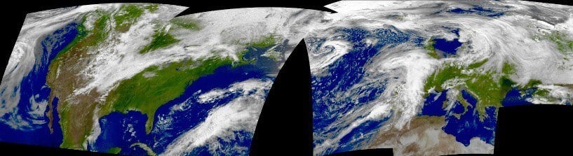
With so many independent people receiving weather satellite images from the NOAA satellites daily, an interesting collaborative task is to stitch these images together to create a wide area composite image. Fortunately the WXtoIMG software already has stitching as a feature.
Over on his website "dodgem37" has created a tutorial explaining how to use WXtoIMG to stitch together multiple NOAA weather satellite images that have been uploaded to individuals websites. As well as the tutorial he has created a table of people's websites that contain recent and the required "pristine" processed images that can be used for stitching.
Weather Satellite Failure Updates
We also wanted to provide a brief update on some weather satellites that we RTL-SDR users often receive.
NOAA 15: About two weeks ago NOAA 15 failed and was producing glitched images. However after a few days it came right again, only to have failed again at the end of last month. It appears that the camera scanning motor is getting stuck due to being low on lubricant as the satellite is now well past it's intended life cycle at 11 years old. If you're interested, some info on how the camera on these satellites works can be found here. There is currently no plan for a fix, the only hope is to wait and see if the motor unsticks.
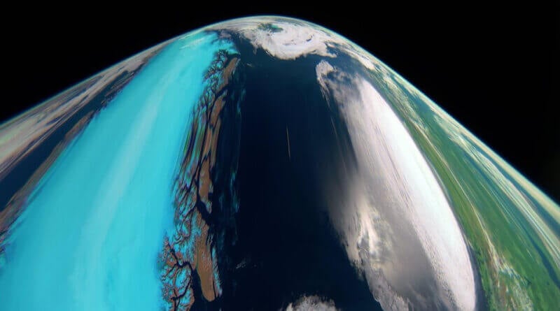
Meteor M2-1: Meteor M2-1 has also recently suffered problems yet again with it's orientation control, and we're regularly seeing off-axis or distorted images that show the curvature of the earth. Over the weekend it was turned off, and should be reset this week. This problem seems to occur and be fixed often, so hopefully it will be back online soon.
Meteor M2-2: The recently launched Meteor M2-2 is functional, but it is still in the testing phase, so is sometimes being turned off. Do not be alarmed if no signal is received sometimes.
GOES-17: GOES-17 is reported to be experiencing problems with it's infrared camera due to a blocked heatpipe, however it appears that they are able to work around this issue and obtain 97% uptime.